48,555 people live in Poway, where the median age is 41.9 and the average individual income is $62,138. Data provided by the U.S. Census Bureau.
Total Population
Median Age
Population Density Population Density This is the number of people per square mile in a neighborhood.
Average individual Income
There's plenty to do around Poway, including shopping, dining, nightlife, parks, and more. Data provided by Walk Score and Yelp.
Explore popular things to do in the area, including The Ice Cream Shop, The Divine Dough, and Flour Child Baking Company.
| Name | Category | Distance | Reviews |
Ratings by
Yelp
|
|---|---|---|---|---|
| Dining | 0 miles | 0 reviews | 0/5 stars | |
| Dining | 0 miles | 1 review | 5/5 stars | |
| Dining | 0 miles | 6 reviews | 5/5 stars | |
| Dining | 0 miles | 0 reviews | 0/5 stars | |
| Dining | 0.67 miles | 2 reviews | 4.5/5 stars | |
| Dining | 0.77 miles | 0 reviews | 0/5 stars | |
| Dining | 1.61 miles | 1 review | 1/5 stars | |
| Dining | 1.67 miles | 0 reviews | 0/5 stars | |
| Dining | 1.75 miles | 1 review | 5/5 stars | |
| Shopping | 1.61 miles | 0 reviews | 0/5 stars | |
| Active | 0.58 miles | 0 reviews | 0/5 stars | |
| Active | 0.67 miles | 0 reviews | 0/5 stars | |
| Active | 0.67 miles | 0 reviews | 0/5 stars | |
| Active | 1.04 miles | 13 reviews | 5/5 stars | |
| Active | 1.31 miles | 10 reviews | 4/5 stars | |
| Active | 1.31 miles | 1 review | 1/5 stars | |
| Active | 1.48 miles | 64 reviews | 4.5/5 stars | |
| Active | 1.59 miles | 5 reviews | 3.6/5 stars | |
| Active | 1.61 miles | 1 review | 5/5 stars | |
| Active | 1.61 miles | 0 reviews | 0/5 stars | |
| Active | 1.74 miles | 6 reviews | 4.3/5 stars | |
| Beauty | 0 miles | 150 reviews | 4.5/5 stars | |
| Beauty | 0 miles | 1 review | 5/5 stars | |
| Beauty | 1.09 miles | 2 reviews | 5/5 stars | |
|
|
||||
|
|
||||
|
|
||||
|
|
||||
|
|
||||
|
|
Poway has 16,421 households, with an average household size of 2.91. Data provided by the U.S. Census Bureau. Here’s what the people living in Poway do for work — and how long it takes them to get there. Data provided by the U.S. Census Bureau. 48,555 people call Poway home. The population density is 1,147 and the largest age group is Data provided by the U.S. Census Bureau.
Total Population
Population Density Population Density This is the number of people per square mile in a neighborhood.
Median Age
Men vs Women
Population by Age Group
0-9 Years
10-17 Years
18-24 Years
25-64 Years
65-74 Years
75+ Years
Education Level
Total Households
Average Household Size
Average individual Income
Households with Children
With Children:
Without Children:
Marital Status
Blue vs White Collar Workers
Blue Collar:
White Collar:
Poway calls itself "The City in the Country," and the label is a land-use fact before it is a slogan: the city says more than half of its 39.4 square miles is dedicated open space, threaded by 78 miles of trails, and the U.S. Census Bureau's boundary puts the incorporated area at 39.08 square miles of land. It sits in northeast San Diego County three miles east of Interstate 15 and just west of State Route 67, with the City of San Diego's Rancho Bernardo, Sabre Springs, Scripps Ranch and Rancho Penasquitos on its west and south, Escondido to the north and Ramona beyond the ridges to the east. Poway incorporated in December 1980 as a full-service general law city, absorbing the two water districts that had served the valley since the 1950s, and City Hall is at 13325 Civic Center Drive.
For buyers comparing Poway real estate, the housing is overwhelmingly detached and older than the city: the California Department of Finance counted 50,263 residents on January 1, 2026 and 17,819 homes, of which 12,991, about 73 percent, are single-family detached houses, 2,822 sit in buildings of five or more units and 780 are mobile homes. The city's Housing Element records that 34.8 percent of the stock was built in the 1970s and 55.9 percent was over 40 years old in 2018. In the Greater San Diego Association of REALTORS report for ZIP 92064, the median detached sale price year to date through August 2026 was $1,402,500, up 9.4 percent from a year earlier; the exact figures, their ZIP scope and their limits are linked in the market section below. That median is orientation, not a price for a 1970s tract house off Twin Peaks Road or a two-acre parcel in the rural east.
Three things shape almost every decision here. The rural residential zones on the east and north allow 0.25 to one home per acre on lots of one to 40 acres, and a 1988 voter measure, Proposition FF, means they cannot be rezoned denser without a vote of Poway residents. Northern Poway is largely inside a Very High Fire Hazard Severity Zone, which sets the cost of building, insuring and maintaining a home there. And the 2017 Poway Road Specific Plan concentrates nearly all new housing along a 2.65-mile stretch of Poway Road, so the corridor is where the city will change while the tracts and the acreage stay much as they are. Use this guide with the listings above, then bring the comparison down to a specific street, a specific lot and its rules.
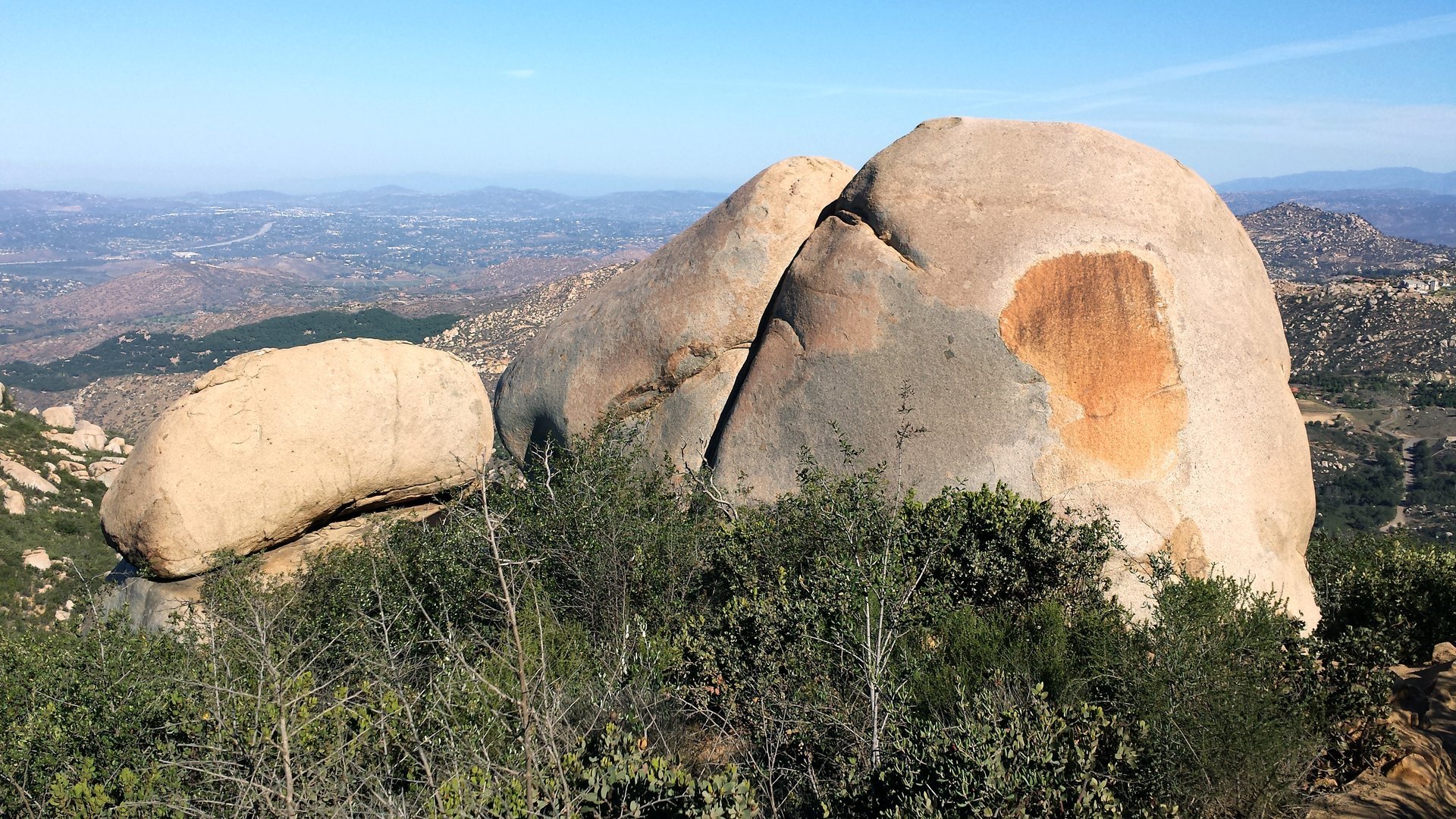
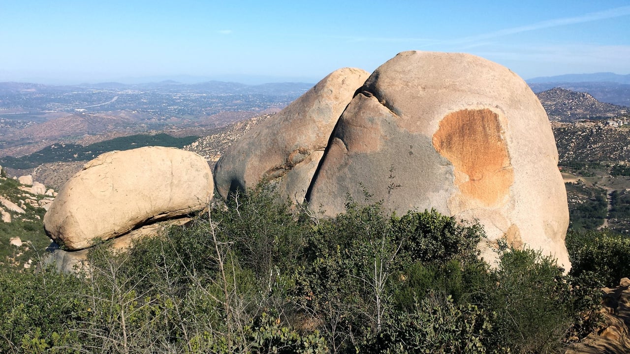
Granite boulders on the Mount Woodson Trail above Poway in September 2015. The 6.6-mile round trip to Potato Chip Rock starts at the Lake Poway trailhead inside the city.
01 / The directory
Poway's real neighborhoods follow its planning map more than its marketing names. The useful way to organize a search is by the city's own zones and eras: the Old Poway townsite along Midland Road, the Poway Road corridor and its Town Center, the subdivision belt built from 1959 through the 1980s on the valley floor, North Poway along Espola Road with its open-space and fire-hazard constraints, the rural residential east toward State Route 67, the mobile home park zone, and the South Poway Planned Community that holds the Business Park. The groups below come from the city's General Plan and Housing Element, its history pages and its zoning handouts, not from listicle labels that settle nothing about schools, zoning or value.
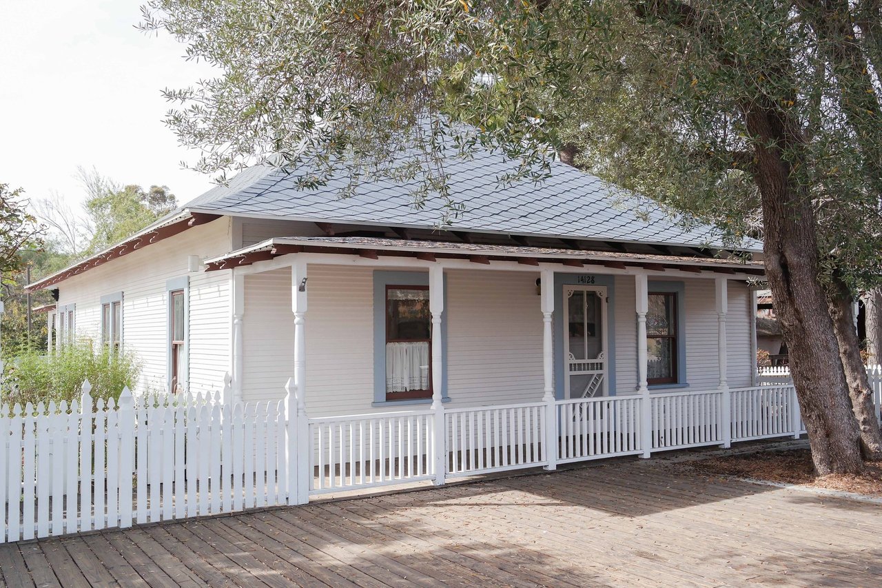
The original townsite centers on Midland Road between Twin Peaks Road and Hilleary Place, where the city's history page places Old Poway. Old Poway Park, nearly five acres at 14134 Midland Road, holds Templar's Hall, the Nelson House, the Porter House and the Poway-Midland Railroad that Colonel John Porter began in the 1960s; the city bought the land in 1986 and dedicated the park on July 4, 1994. The streets around it carry Poway's oldest houses, some pre-dating the 1959 Poway Valley Homes subdivision, mixed with later infill. A house here can be a century old with many changes, so compare the original structure with its additions and confirm permits with Development Services rather than trusting a listing remark.
This is the part of the city that is changing. The Poway Road Specific Plan, adopted December 5, 2017, covers 235 acres along 2.65 miles of Poway Road between Oak Knoll Road and Garden Road and caps the corridor at 1,399 homes, a net gain of up to 1,148, with a Town Center district between Carriage Road and Community Road allowing up to 30 units per acre and a maximum height of 38 feet and three stories in most areas. Poway Commons, approved December 17, 2019 on both sides of Poway Road west of Tarascan Drive and Civic Center Drive, added 141 homes: 83 market-rate homes for sale on the south side, 14 on the north and 44 senior affordable apartments, with private streets kept by a homeowners association. The Outpost with 53 units and Fairfield with 212 followed in the Housing Element's count. A condominium or townhome here trades a yard for walkability to the library, City Hall, Community Park and the bus; ask the Planning Division what the plan allows on the parcel next door before assuming a view or a quiet street will stay as it is.
Most Poway houses sit in the tracts that began with Poway Valley Homes in 1959 and filled the valley floor through the 1980s, on streets off Twin Peaks Road, Pomerado Road, Community Road, Garden Road and Espola Road's lower reaches. The Housing Element's age table is the useful map: 1,085 homes from the 1950s, 2,100 from the 1960s, 5,733 from the 1970s and 3,351 from the 1980s, on lots the Housing Element describes as mostly RS-7 zoning in "already developed areas." On a 1970s lot the questions repeat on every street: room additions and garage conversions, the permit record for each, the roof, the electrical service, the sewer connection and whether the yard is level and usable. Our own team ledger's Poway closings, from Powers Road to Orange Blossom Lane, are all houses built between 1959 and 1973 in these tracts.
North of Twin Peaks Road, the city climbs toward Lake Poway, Blue Sky Ecological Reserve and the Mount Woodson slopes along Espola Road. The Housing Element states that "northern Poway is subject to many constraints and is largely within Very High Fire Hazard Areas, biologically sensitive habitat areas, and open space resource areas where low density residential is required," and it noted in 2021 that the nearest supermarket to northern Poway was at Pomerado Road and Espola Road. Houses here are larger, newer and on bigger lots, with ridgeline views and trail access, and they carry the costs the Housing Element attaches to the Wildland Urban Interface: defensible space, fire-resistant construction, sprinklers, water service and access. Insurance availability and cost belong in the first conversation, not the last. The Poway Center for the Performing Arts and Poway High School sit on Espola Road at the edge of this area.
East of the valley toward State Route 67, and on the ridges north and south, Poway's RR-A, RR-B and RR-C zones allow 0.25 to one home per acre on minimum lots of one to 40 acres, and the Housing Element notes there is more land in the RR-A and RR-C zones individually than in the whole RS-7 tract zone. Proposition FF, passed in November 1988, requires a vote of Poway residents before rural residential, open space or planned community land can be redesignated to a denser category, which is why these parcels stay large. Large animals are allowed by lot size under the city's large-animal rules: from two animals on a lot of 10,001 to 15,000 square feet up to six per acre and nine in total, or ten per acre in RR-A and RR-B with a minor conditional use permit, with enclosures set 35 to 60 feet from a neighbor's home. A rural parcel is an infrastructure purchase: the Housing Element allows either sewer or a county-approved septic system, wells and private roads are common, and the Poway Valley Riders Association grounds on Tierra Bonita Road are the community's equestrian anchor.
The state counts 780 mobile homes in Poway, and the Housing Element records 695 spaces in the city's Mobile Home Park zone, where mobile home parks are the only permitted use. A mobile home purchase is a space-rent decision: the park's rent history, its rules and its ownership matter more than the ZIP median, and financing works differently from a house.
The South Poway Planned Community holds the 700-acre Poway Business Park, begun in the late 1980s and home, by the city's account, to more than 500 businesses and more than 18,000 jobs, including the headquarters of General Atomics Aeronautical Systems, which the city's 2019 financial report listed at 7,160 employees. Proposition FF also bars adding residential units in the Business Park without a vote, so this is an employment district that shapes commutes and the Scripps Poway Parkway corridor rather than a neighborhood to buy into.
Poway's 2020-2029 regional housing allocation is 1,319 homes, 0.8 percent of the region's total, and the Housing Element counted the units built or entitled before 2023 at 59 percent of that need, with 742 units of remaining corridor capacity. The element was adopted August 3, 2021 and readopted April 2, 2024 after review by the state housing department, which had found the city out of compliance in 2022; no certification letter for the 2024 adoption was located, so this guide does not claim one. The city processes state lot-split and two-unit projects in single-family zones ministerially, and its 2019 accessory-unit rules roughly doubled the number of accessory units permitted. New attached homes are therefore concentrated on Poway Road, and a rendering in a listing is not an approval, a completion date or proof of the parking that will be delivered.
Which part of Poway fits your budget, commute and school needs? Ask us to narrow the search.
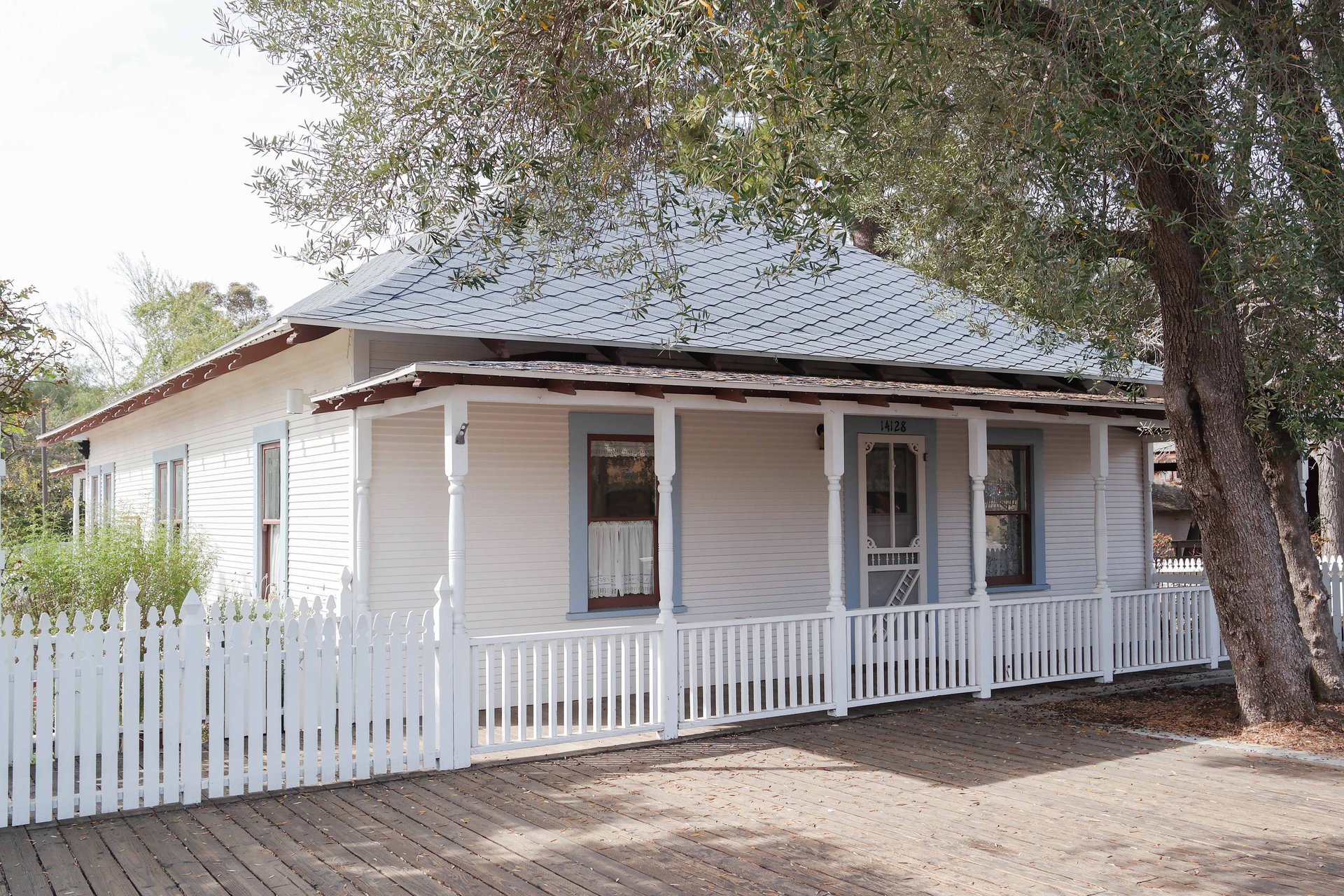
The Nelson House at Old Poway Park, photographed in February 2014, one of the preserved buildings in the original townsite along Midland Road. The park's Heritage Museum and Nelson House open on Saturdays.
02 / Prices
The most useful public market data for Poway comes by ZIP code from the Greater San Diego Association of REALTORS, using San Diego MLS records. In its Local Market Update for August 2026 for ZIP 92064, the year-to-date median sale price for detached homes through August 2026 was $1,402,500, up 9.4 percent from $1,282,000 a year earlier, on 238 closed sales, with a median of 32 days on market until sale and 98.4 percent of original list price received. For August alone, 23 detached homes closed at a median of $1,530,000, with 64 homes in inventory and 2.2 months of supply, down from 119 homes and 4.5 months in August 2025. Attached homes closed at a year-to-date median of $750,000, unchanged from a year earlier, on 37 sales with 39 days on market. The report is current as of September 5, 2026 and was checked September 16, 2026.
Read those figures with two cautions the publisher states itself: percentage changes are calculated on rounded figures and "can sometimes look extreme due to small sample size," and the geography is the ZIP code, which is Poway's only ZIP but not the municipal boundary. The August detached median is one month of 23 sales; the year-to-date median is the steadier number. Inventory is the signal that changed most this year: 64 detached homes for sale at the end of August against 119 a year earlier means sellers of well-kept houses face fewer competitors than they did in 2025.
What moves a Poway price is usually visible from the driveway: the lot, its slope and whether it is usable or mostly hillside; the year built and the permit history of additions on a 1970s tract house; the fire-hazard zone and the insurance it implies in the north and east; the zoning that decides whether a parcel can keep horses or add a unit; and, on the corridor, an association and what the specific plan allows next door. A 1970s house with a permitted addition and a tired one on the same street can sit hundreds of thousands of dollars apart, and a two-acre RR parcel with a well and a private road needs its own set of comparables. We would rather explain the difference between three relevant closings than hand you a ZIP median that blends a Poway Commons townhome with a ranch on two acres in the rural east.
Housing choice | Typical comparison | Association review | Special charges and other costs | What to compare closely |
|---|---|---|---|---|
1960s or 1970s tract house on the valley floor | Original layout versus expanded, updated or added-unit resale in the same tract | Usually none; confirm for the parcel | Property tax, city water and sewer bills, any landscape maintenance district assessment, original systems | Permit history, garage conversion, roof and electrical, usable yard, sewer connection |
North Poway house on Espola Road or the Lake Poway slopes | Lot size, view and year built against the same area's closings | Varies by tract | Fire-zone insurance, defensible-space upkeep, water service, longer driveways | Fire hazard severity zone, insurance quotes, open-space and habitat constraints on the parcel |
Rural residential parcel (RR-A, RR-B, RR-C) | Acreage, water source, road and animal rights against other rural parcels | Usually none; private road agreements common | Well or water service, septic or sewer, private road maintenance, fire-zone insurance | Zoning and Proposition FF status, large-animal allowance, easements, septic condition |
Poway Road corridor condominium or townhome | Unit, parking and building age against Poway Commons and corridor closings | Dues, reserves, insurance, rental rules | Owner coverage, any assessments | The specific-plan district next door, association finances, bus and library walkability |
Mobile home in the Mobile Home Park zone | Space rent and park rules versus purchase price | Park management, not an association | Space rent, park utilities, registration | Lease term, rent history, park ownership and condition of the unit |
Home with an accessory unit or SB 9 split | Permitted unit versus unpermitted conversion | None; city permit record governs | Impact and stormwater fees on units of 750 square feet or more, separate utilities | Permit and occupancy record, the 30-day minimum rental term, parking, access |
This is a comparison of questions to investigate, not a fee schedule. Poway homes are taxed through the County of San Diego; the Treasurer-Tax Collector lets you look up a bill by parcel number or mailing address, with installments due November 1 and February 1, and the county's Mello-Roos page explains how to find any special tax by parcel number. Some Poway subdivisions sit in city landscape maintenance districts billed on the same tax bill, and water and sewer are billed by the city, which absorbed the two water districts at incorporation; confirm the current charges for the address with the city rather than relying on an older figure. Most of the city's detached housing carries no association, but the corridor projects and some northern tracts do; read the actual tax bill and title report for the exact address. Use the mortgage calculator to test financing assumptions, then replace estimates with a lender's figures, an insurance quote and verified property costs.
For a seller, the closest active listing is competition, while a completed sale is transaction evidence. Both matter, and with 2.2 months of detached supply at the end of August 2026 the comparable closings carry more weight than the thin field of competing listings. For a buyer, a price reduction is a reason to revisit the evidence and the condition, not automatic proof of a bargain. If you are weighing inland against the coast, the Carlsbad guide and the Del Mar guide cover North County beach cities with their own price levels; each is a separate market with its own window.
Ask for Poway comparable sales matched to your home type, lot and condition.
03 / Schools
Public schools in Poway belong to the Poway Unified School District, which is headquartered outside the city at 15250 Avenue of Science in San Diego and, in the city's words, is the third-largest district in the county, serving more than 35,000 students across 100 square miles and the communities of 4S Ranch, Del Sur, Torrey Highlands, Rancho Penasquitos, Carmel Mountain Ranch, Poway, Rancho Bernardo and Sabre Springs. The city counts eleven district schools inside its limits: two high schools, two middle schools, seven elementary schools and an adult school. Poway High School at 15500 Espola Road dates to September 1961; the district's boundary pages name Twin Peaks and Meadowbrook among its middle schools and Garden Road, Midland, Painted Rock, Pomerado, Tierra Bonita and Valley among its elementary campuses, and its high school maps cover Poway, Rancho Bernardo, Mt. Carmel, Del Norte and Westview.
A Poway address does not settle which campus a student attends. The district publishes separate high school, middle school and elementary boundary maps and an address lookup for the 2026-2027 school year, with its own disclaimer that accuracy "cannot be guaranteed" and that families "must confirm attendance eligibility with either the designated school or the Planning Department." Use the full street address and the intended school year, then confirm with the school. Some Poway addresses feed Rancho Bernardo or Mt. Carmel campuses in San Diego, and a school name in a listing should trigger an address check before an offer, not replace one.
The nearby-schools module above is a discovery tool. It lists campuses inside and outside the city limits, including district schools in Rancho Bernardo and Sabre Springs, and its ratings do not establish that a particular property is assigned to any of them. Compare schools on the things that matter to your student: grade span, programs, transportation, schedule and the enrollment process. The district's community facilities districts, which fund newer campuses, are in the San Diego communities rather than Poway according to its own CFD pages, but any special tax is a parcel-level fact to confirm on the county lookup.
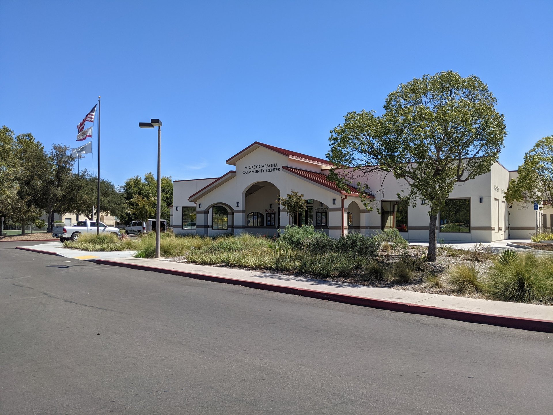
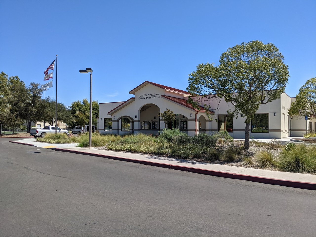
The Mickey Cafagna Community Center at Poway Community Park, photographed in August 2022, part of the civic cluster with City Hall on Civic Center Drive and the county library on Poway Road.
04 / Commute
No freeway runs through Poway. The city describes itself as three miles east of Interstate 15 and just west of State Route 67, with San Diego International Airport 24 miles to the south. The everyday connections are Poway Road west to I-15 at the Poway Road and Rancho Penasquitos Boulevard interchange, Scripps Poway Parkway west to I-15 at Mercy Road and east to SR 67, and Pomerado Road north toward Rancho Bernardo and Escondido; portions of Pomerado Road were once U.S. Route 395. I-15 between Scripps Poway Parkway and Camino del Norte carries the Tony Gwynn Memorial Freeway name, and the Express Lanes are reached from SR 56 and the Sabre Springs-Penasquitos Transit Station. SR 67 passes through the eastern city as an undivided highway on its way to Ramona, and the SR 56 extension that the 1980 city plan once reserved has no construction plans. Drive your actual route at the hours you will use it before treating any house as convenient; the Business Park's 18,000 jobs make Scripps Poway Parkway a commute of its own.
Transit is bus only. San Diego MTS Route 944 runs from the Sabre Springs and Penasquitos Transit Station to Poway High School via Poway Road, and Route 945 runs from the Rancho Bernardo Transit Station to Poway High School via Pomerado Road and Poway Road, both effective June 7, 2026, with stops that include the Poway Library, Palomar Medical Center Poway, Meadowbrook Middle School and Twin Peaks Plaza. Both transit stations connect to Rapid and local routes toward downtown San Diego and Escondido. Calculate the full door-to-door trip, including the bus leg to the station, and check the current timetable for your hours.
Buyers weighing inland North County and East County can compare the Escondido guide up I-15, the El Cajon guide at the other end of SR 67, and the La Mesa guide for a trolley-served inland alternative closer to downtown; each is a separate market with its own window.
05 / Daily life
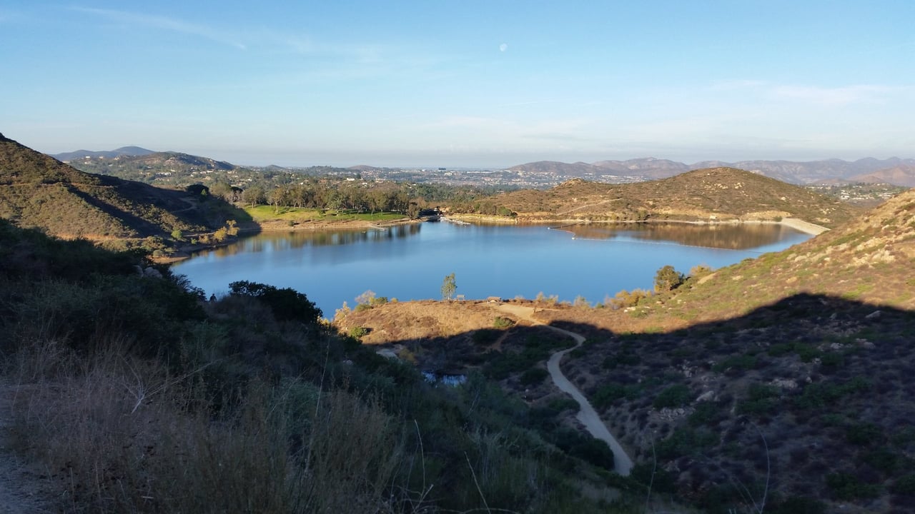
Poway's daily life runs outdoors. Lake Poway at 14644 Lake Poway Road has been the city's water supply and its recreation area since 1972, behind an earthen dam 165 feet high that voters approved with an 87 percent bond vote in June 1969 after two failed attempts; gates open at 6 a.m. daily and close at sunset, fishing and boating are closed early in the week on the city's schedule, non-residents pay a $10 fee, and the Youth Fishing Derby ran for the 31st time in 2026. The lake trailhead is the start of the 6.6-mile round trip to Potato Chip Rock on Mount Woodson, the 2,901-foot summit the Kumeyaay called Ewiiy Hellyaa. Blue Sky Ecological Reserve, a 700-acre canyon entered at 16275 Espola Road, is owned jointly by the state Department of Fish and Wildlife, the county and the city, opens sunrise to sunset, runs free docent-led hikes every weekend and connects by the Green Valley Truck Trail to Lake Ramona 2.4 miles from the trailhead; bicycles are not allowed there. The city's trail system of more than 78 miles is open sunrise to sunset to hikers, bikers and riders, with horses given the right of way and some segments crossing private property by the owners' consent.
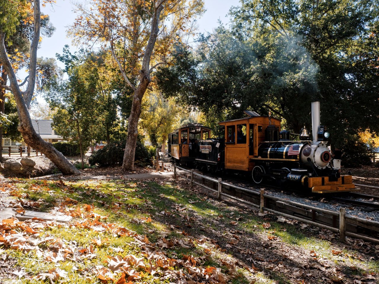
The civic and historic center is compact. Old Poway Park at 14134 Midland Road hosts the Poway-Midland Railroad on weekends, a Heritage Museum open Saturdays from 10 a.m. to 2 p.m. and the Poway Farmers Market every Saturday from 8 a.m. to 1 p.m. with more than 65 vendors. Community Park on Civic Center Drive has the skate park, ball fields, Adventure Playground, the dog park and the senior center; the Poway Branch Library of the San Diego County Library, at 13137 Poway Road, is open seven days a week with a community room, a Friends bookstore and a 3D printer. The Poway Center for the Performing Arts at 15498 Espola Road runs a subscription season and the Poway Onstage and Poway Youth Theater programs. The Kumeyaay-Ipai Interpretive Center at Pauwai, at 13104 Ipai Waaypuk Trail, opens on the third Saturday of each month with docent-led tours of a village site, a partnership of the city, the Friends of the Kumeyaay and the San Pasqual Band. The Poway Rodeo holds its 54th annual performances on September 25 and 26, 2026 at the Poway Valley Riders Association grounds at 14336 Tierra Bonita Road. Palomar Medical Center Poway at 15615 Pomerado Road, opened in 1977 as Pomerado Hospital, is licensed for 236 beds according to the state's facility record.
Water is part of daily life here in a way it is not in most cities. In November 2019 storm water backed up into the 1964 clearwell beside the Lake Poway treatment plant, and the city issued a precautionary boil-water advisory on November 30 that it lifted on December 6 after two clean state-required tests. The city's Water Infrastructure Program, which it calls the largest capital program in its history, replaced that clearwell: temporary tanks were built on the Lake Poway ballfield in 2021 and 2022, construction of the new tanks began in December 2023, the city's timeline shows them commissioned in July 2026 with completion expected in fall 2026, and a new treated-water connection to the County Water Authority is planned for 2027. Ask the city for the current status when you buy.
At the property itself, spend time outside. Is the lot level and usable, or mostly slope? Where does the trail easement run, and can you hear Poway Road or Scripps Poway Parkway from the yard? In the north and east, what does the defensible-space clearance look like, and who maintains the road? These observations make the amenities conversation specific to the house instead of relying on a broad city description.
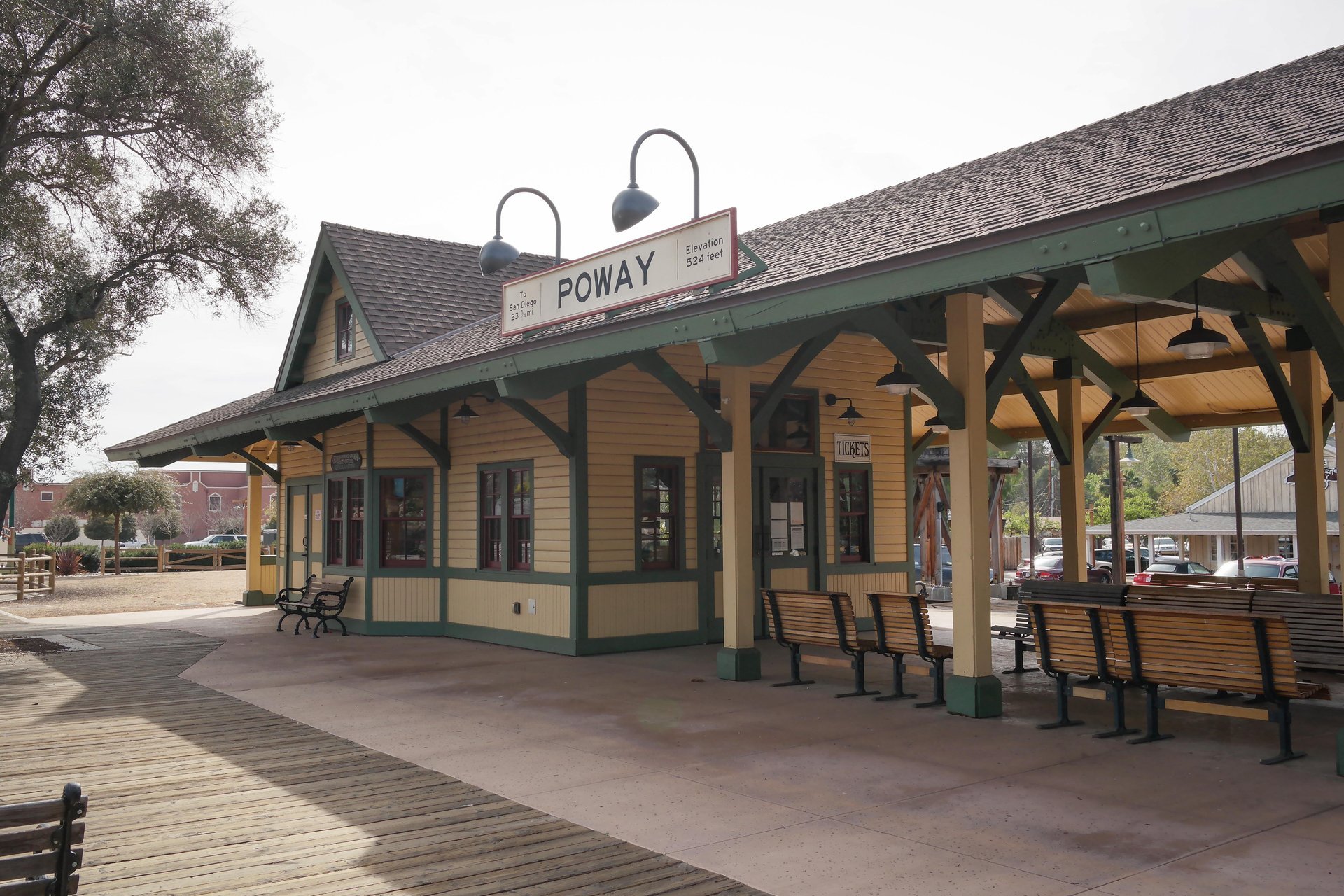
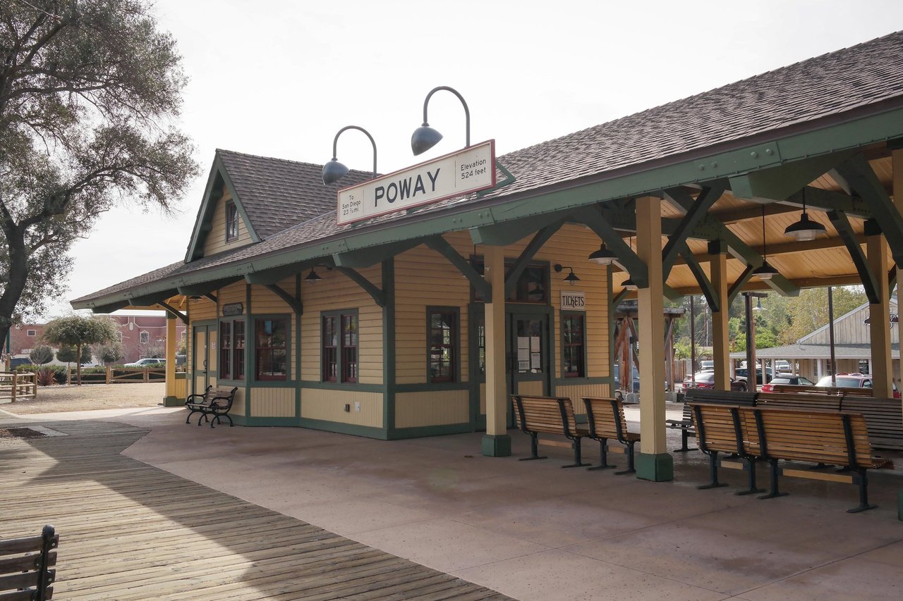
The depot at Old Poway Park, photographed in February 2014, where the Poway-Midland Railroad runs on weekends and the Saturday farmers market sets up along Midland Road.
06 / Selling
A strong Poway listing makes its most useful differences easy to verify. For a 1960s or 1970s tract house, that is the permit record for every addition and conversion, the age of the roof and systems, a level and usable yard and any legal accessory unit; buyers here ask about additions early because most of the stock is more than 40 years old. For a North Poway or rural home, it is the fire-hazard designation, the insurance history, the defensible-space condition, the water source and the road agreement; the city offers a real estate defensible-space inspection under state law AB 38 through its online services, and a completed inspection removes a question from the buyer's list. For a corridor condominium, it is the association's finances, the parking assignment and an honest account of what the specific plan allows around it.
Know the rules that follow the property. The city's accessory-unit handout, updated June 2024, allows a detached unit up to the lesser of half the primary home's floor area or 1,500 square feet, with at least 1,200 square feet permitted, a junior unit up to 500 square feet, one parking space for an accessory unit and none for a junior unit, and requires rental terms of more than 30 days; state law has moved since then, and the state housing department wrote to the city in October 2025 that the ordinance on file dates from 2019, so confirm the current rules with Planning before marketing an accessory unit's income. Poway's Housing Element carries a policy that discourages short-term rentals of rooms or whole homes, and no local short-term rental ordinance was found in this research; do not sell a vacation-rental income story you cannot document. No local rent-control or just-cause ordinance appears on the city's landlord and tenant page, so state law governs a tenant-occupied sale; know the notice rules before you set a timeline.
Prepare the record before you ask buyers to decide: permits, receipts for major work, warranties, association documents where relevant, the insurance declarations page and the current tax bill with any landscape district or special charges. Prioritize repairs by what the likely buyer will compare and by an actual budget; the home-maintenance guide is a starting list, while your property's inspection findings should set the final plan. Timing and pricing should follow your segment, not the ZIP median: with 64 detached homes for sale at the end of August 2026, a well-documented tract house competes with few listings, while a rural parcel competes with every other parcel a buyer can find within the same drive of I-15. Justin Tye and the team can organize that comparison, prepare the presentation and manage the path from inquiry through negotiation and closing. Begin with your address and your goals so the plan reflects the property you are actually selling.
Tell us about your property through our home-selling page. For an initial estimate, you can also use the existing home-valuation tool and follow up with an address-specific discussion.
07 / Why Justin
Our team's closed-sale record includes 26 Poway closings in the compiled ledger, every one a detached house in ZIP 92064 built between 1959 and 1973, from Powers Road and Seiler Street to Orange Blossom Lane and La Venta Drive, with the eight most recent listed below. That is the heart of the Poway market, and it is the kind of experience that matters here: the permit history of a 1970s addition, the fire-zone insurance quote, the difference between a usable half acre and a hillside, and the zoning that decides whether a buyer can keep a horse or add a unit all change what a property is worth, and we read each of them before we talk about price. Beyond this city, the team's Southern California record stands at more than 13,500 team sales.
Working with Justin Tye and the team begins with a clear brief: the housing form you want, your budget, the destinations that shape your week and the details that could change the decision. For a buyer, that means a focused search and a documented comparison of the actual closings that resemble the house you are considering. For a seller, it means preparation, presentation and pricing that buyers can verify. Questions about school assignment, permits, zoning and fire-zone status are resolved with the district, the city, the county and qualified professionals, not with assumptions.
Street | ZIP | Closed | Sold price | Represented |
|---|---|---|---|---|
La Venta Drive | 92064 | July 2023 | $1,000,777 | Buyer |
El Mar Avenue | 92064 | February 2023 | $938,501 | Buyer |
Seiler Street | 92064 | August 2022 | $689,000 | Buyer |
Buckskin Trail | 92064 | June 2022 | $795,000 | Seller |
Orange Blossom Lane | 92064 | May 2022 | $1,100,000 | Seller |
Orange Blossom Lane | 92064 | May 2022 | $1,130,000 | Seller |
Powers Road | 92064 | April 2022 | $881,900 | Seller |
Tobiasson Road | 92064 | March 2022 | $900,000 | Both |
Eight most recent eligible team closings in the City of Poway from the compiled closed-deal ledger, checked September 16, 2026: deduplicated by date and address, with listing, buyer or both sides counted and other roles excluded. The two Orange Blossom Lane rows are separate houses. These are historical team transactions, not current comparable sales, market share or a claim that Justin personally represented every side. No local client review met our verification standard for this page, so none is quoted.
Call (949) 381-8581, send us a note about your Poway plans, or browse Poway homes and save your search. Justin Tye | CA DRE# 01728694.
08 / Questions
Yes. Poway incorporated in December 1980 as a full-service general law city after decades as an unincorporated part of San Diego County, and the U.S. Census Bureau's boundary covers 39.08 square miles of land. The City of San Diego's Rancho Bernardo, Sabre Springs, Scripps Ranch and Rancho Penasquitos communities lie on its west and south, Escondido to the north and unincorporated county land toward Ramona to the east. A Poway mailing address in ZIP 92064 can sit outside the city line, so confirm the jurisdiction of any parcel on the municipal map before comparing taxes, permits, zoning or services.
For ZIP 92064, the Greater San Diego Association of REALTORS reported a year-to-date median detached sale price of $1,402,500 through August 2026, up 9.4 percent from a year earlier, with a median of 32 days on market and 98.4 percent of original list price received; the August 2026 median alone was $1,530,000 on 23 sales. Attached homes closed at a year-to-date median of $750,000. The report is current as of September 5, 2026. One month's sample moves these figures, and a tract house, a rural parcel and a corridor condominium are three different markets, so use them for orientation and ask for comparable sales matched to your property type, lot and condition before pricing an offer or a listing.
The Poway Unified School District, headquartered at 15250 Avenue of Science in San Diego, serves the whole city; eleven of its schools are inside Poway, including Poway High School at 15500 Espola Road and the Twin Peaks and Meadowbrook middle schools. The district assigns students by home address through separate elementary, middle and high school boundary maps and an address lookup that carries its own no-guarantee disclaimer, and some Poway addresses feed campuses in Rancho Bernardo. Verify the assigned campus for a full street address with the district's Planning Department or the school before you rely on it.
By road, mostly. Poway Road and Scripps Poway Parkway connect to Interstate 15 three miles west, Pomerado Road runs north to Rancho Bernardo and Escondido, and State Route 67 crosses the eastern city toward Ramona and Lakeside; the airport is 24 miles south by the city's measure. MTS Routes 944 and 945 link Poway Road, Pomerado Road and Poway High School to the Sabre Springs and Rancho Bernardo transit stations, where Rapid and local routes continue toward downtown and Escondido. Calculate the full door-to-door trip, including the bus leg and the I-15 interchange at your hours, and check the current timetable.
Most of the older tract and rural houses carry no association, while the Poway Road corridor projects and some northern tracts do. Some subdivisions sit in city landscape maintenance districts billed on the county tax bill, water and sewer are billed by the city, and any Mello-Roos special tax is found by parcel number on the county's lookup; the school district's community facilities districts serve its San Diego communities rather than Poway according to the district's own pages, but the parcel record governs. Read the current tax bill and title report for the exact address, and for a rural parcel add the well, septic and private road costs.
Often, depending on the parcel. Large animals are allowed by lot size under the city's rules: at least 10,000 square feet for two animals, six per acre up to nine on larger lots, and ten per acre in the RR-A and RR-B zones with a minor conditional use permit, with enclosures set back from neighboring homes. Accessory units are allowed on single-family lots under the city's June 2024 handout, with a detached unit up to 1,500 square feet, a junior unit up to 500, and a rental term of more than 30 days; state law has changed since and the state housing department flagged the city's 2019 ordinance in October 2025, so confirm the current rules with the Planning Division. Proposition FF means rural residential land cannot be rezoned denser without a citywide vote.
Serious in the north and east and a normal part of ownership there. The city's Housing Element states that northern Poway is largely within Very High Fire Hazard Areas, and homes in the Wildland Urban Interface carry added fire-code requirements for defensible space, construction, sprinklers, water service and access. The city runs a wildfire defensible-space program and an annual vegetation management program, offers AB 38 defensible-space inspections for real estate transactions, and the Housing Element requires undergrounded utilities in new subdivisions in those zones. Get an insurance quote for the exact address before you write an offer, and check the parcel against the city's fire hazard map.
Begin with the home-valuation tool for a first reference, then request an address-specific comparison. A useful pricing recommendation explains the relevant completed sales in your tract or zone, the competing listings and the differences in lot, permits, condition, fire-zone status and ownership costs. Neither a ZIP-code median nor an automated estimate establishes what a particular buyer will pay for a particular house on a particular street.
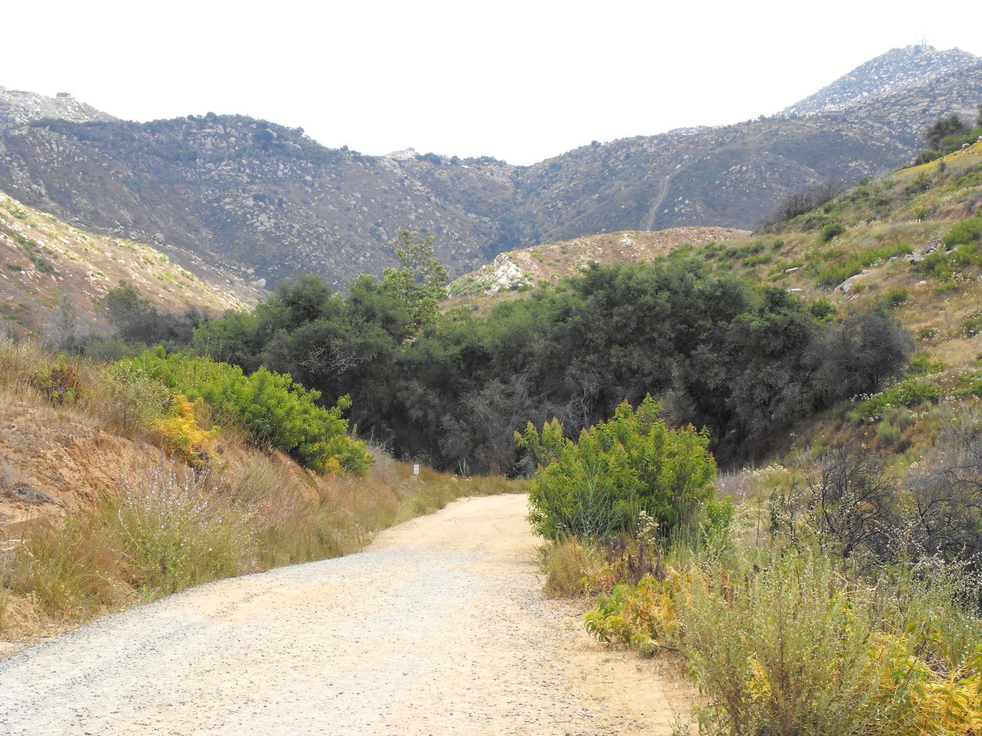
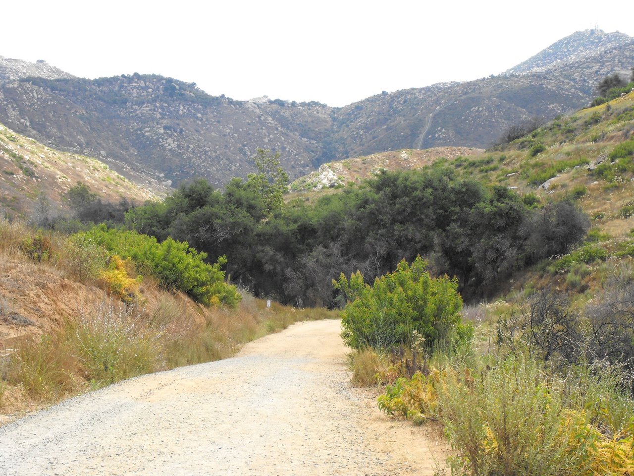
The entrance trail at Blue Sky Ecological Reserve off Espola Road, photographed in June 2009. The 700-acre canyon connects to Lake Poway and Lake Ramona and borders the northern neighborhoods.
Continue with our neighborhood directory, compare Escondido up Interstate 15, El Cajon at the other end of State Route 67, or the coast at Oceanside and Carlsbad, read the first-time buyer planning guide and Justin's real estate articles, or use the Poway home search. Connect with Justin Tye when you are ready to bring the comparison down to a specific address.
Prepared for JustinTye.com. Substantive research reviewed September 16, 2026. Market window: Greater San Diego Association of REALTORS Local Market Update for August 2026, ZIP 92064, San Diego MLS data current as of September 5, 2026. Housing counts: California Department of Finance E-1 and E-5, January 1, 2026 provisional estimates, released May 2026. Housing age, tenure and zoning: City of Poway 2021 Housing Element, 2018 ACS tables and Chapter 3 zoning summary. Municipal boundary: U.S. Census Bureau TIGERweb. Native provider-area data and nearby-school results above are separate from the sourced municipal and address-specific guidance in this article. Photographs identify places and context; they do not depict current listings.
Photography credits
Lake Poway from the Mount Woodson Trail: RightCowLeftCoast, CC BY-SA 4.0. Mount Woodson Trail boulders: chrisinphilly5448, CC BY-SA 2.0. Nelson House at Old Poway Park: Visitor7, CC BY-SA 3.0. Mickey Cafagna Community Center: Lonnez, CC BY-SA 4.0. Poway depot at Old Poway Park: Visitor7, CC BY-SA 3.0. Blue Sky Ecological Reserve: Stickpen, public domain. Poway-Midland Railroad locomotive No. 3: troy sankey, CC BY-SA 2.0. MV-22 Osprey over Poway: Cpl. Steven H. Posy, U.S. Marine Corps, public domain. Images scaled to web size with their original aspect ratios; no scene content altered. Photographs do not depict current inventory or present conditions.